New Boston Historical Society
New Boston, New Hampshire
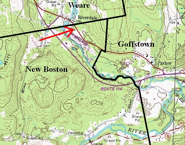
Riverdale: a Hidden Village
If you ask the average citizen of New Boston "Where is Riverdale?" chances are you will not get a satisfactory answer. If you're lucky, he or she may tell you "I know there's a Riverdale Road somewhere..." but it's likely that they've never followed that road across Route 114 to an unexplored corner of New Boston: the historic village of Riverdale.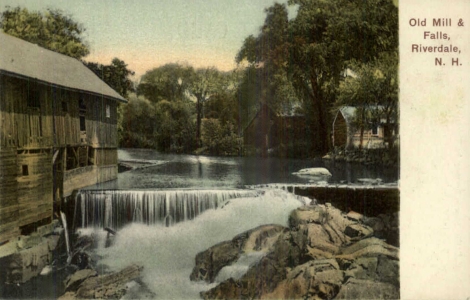 What's unique about Riverdale?
- The town line goes through its center
- Its history is connected with the Revolutionary War
- It once had a train station, and later an airfield
- You won't believe all the things that were made here.
In the late 1800s, when you walked from the Riverdale train station to the nearby Riverdale hotel or post office, you went from Weare to New Boston. Students from both towns attended Riverdale's one-room schoolhouse in Weare, and the old mill in the postcard was in Weare. Today, the Weare school bus turns around at the town line, and there are no children living in either of the two old houses on the New Boston side of the line.
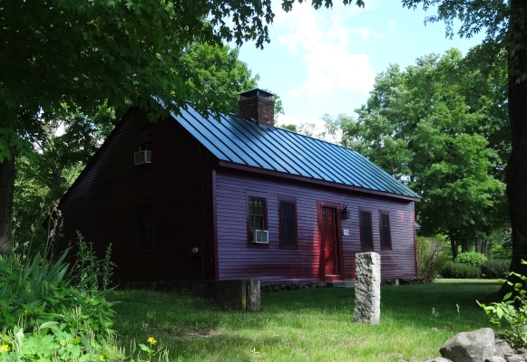
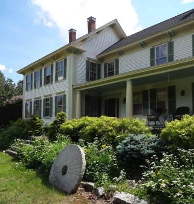
The two historic homes which remain in New Boston's half of Riverdale
 The millstone in front of Wade's house may have come from a Riverdale gristmill.
Another lawn ornament (not shown) is a massive cast-iron flywheel from an up-and-down sawmill.
The millstone in front of Wade's house may have come from a Riverdale gristmill.
Another lawn ornament (not shown) is a massive cast-iron flywheel from an up-and-down sawmill.
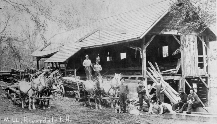
Wade's father T.O. Knowlton would hire men to work on his farm, rent them rooms to live in, and sell them food from his general store. As we inspect entries for individual workmen in T.O. Knowlton's ledger (1871-1903) we see that working for T.O. was not always profitable. The workers may have stayed in the red house or in the large building in the photo below.
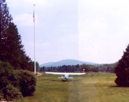
James Hawkes had a small airplane and he built a grass airstrip to the east of his house. Joanne remembers that when the modern Route 114 was being planned her father learned it would go right by his house. He managed to convince the aviation authorities that his airstrip was essential for emergency use, so the road engineers had to reroute the highway over to the other side of the river.
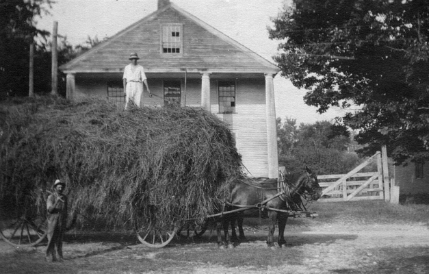 Store / Grange Hall in Riverdale, New Boston
That's Wade Knowlton on top of his haywagon, c.1912-1915. The building behind the wagon stood between the red house and the Weare town line. When fire destroyed most of the building, Wade rescued its four columns. He cut the columns in half and used the top halves as pillars for the front porch of his house (see photo above). Remember this building with its four columns - we'll see it again!
On the reverse of the haywagon photo is written "Store, post office and grange hall". The 1858 map below shows a "Store & P.O." on this site; by 1892 the Post Office had moved elsewhere. (Since the job of Postmaster was a political appointment, it was common for a Post Office to relocate after an election.) It is possible that this building was also used as a hotel or a tavern. Someone remembers seeing a boxing match in the hall.
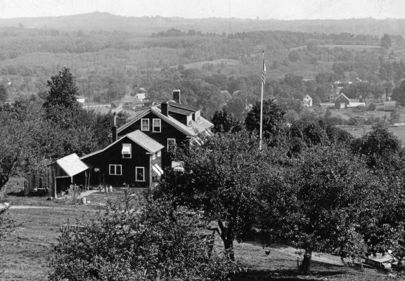
View of Riverdale village from Apple Hill Farm

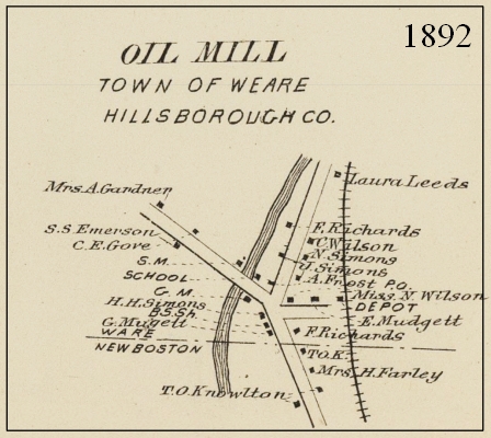
Riverdale was formerly known as Oil Mill village
S.H.=Schoolhouse, S.M.=Sawmill, G.M.=Gristmill(?), B.S.Sh.=Blacksmith Shop
Let's visit the Weare side of Riverdale, which is the bigger half of the village.
The North Branch of the Piscataquog River runs through Riverdale and gives the village its name. It's a relatively new name; in the 1888 History of Weare the village was still known as "Oil Mill village".
The Piscataquog River powered sawmills and gristmills in the village, beginning in 1755. The first Oil Mill was built in 1803. It made linseed oil by cracking flax seeds between iron rollers and then grinding the cracked seed between millstones. (Flax plants were used to make linen before cotton became readily available.)
Made in Riverdale
Long before knitting machines were humming, even before the American Revolution, the most valuable exports from Weare and New Boston were tall pine trees needed for the Royal Navy; in fact, trees over a specific diameter were marked by surveyors, reserved for the King's use and could not be sold. The pines might grow a hundred feet tall; one "took eighty oxen to haul out". To facilitate their transport, Mast Road was built from Riverdale through Goffstown to the Amoskeag River. When New Hampshire sawyers tried to keep some of the big trees for their own customers, the King's men came to arrest them. This led to the Pine Tree Riot of 1772, an act of rebellion which preceded the Boston Tea Party. You may read more about the Riot at the Weare Historical Society's page, since most of the action occured further north in Weare, but the trouble began in Riverdale.
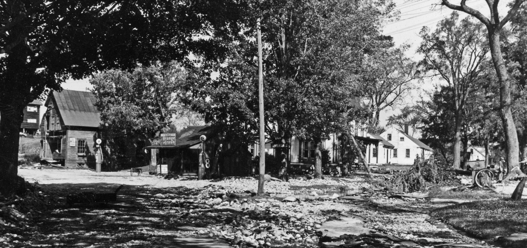
Fire and Flood
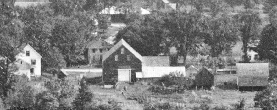
The photo above shows the center of Riverdale in 1938, looking northwest into Weare with New Boston behind us. Depot Street to the right led to a railroad which was no longer in service, its demise hastened by the Flood of 1936. Downed tree limbs and washed out roads are our only hint in this photo that the Flood of 1938 was even worse. Look left, past the gas station with its sign advertising "Orange Crush", and you'll see the Pine Tree Riot Antiques shop. Would you like to look inside?
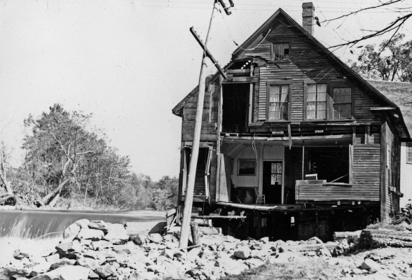 Part of the front wall of the shop is missing. It probably floated down the river, along with the front porch. You can see water rushing over the dam, near the historic mill site. What you cannot see is the bridge, which was washed away by the force of the flood.
Today there is a new bridge in Riverdale, and a new dam. The dam was built as part of a U.S. Army Corps of Engineers project to ensure that Riverdale, Goffstown and other New Hampshire towns and cities are protected from disasters like the Floods of 1936 and 1938.
The antiques shop, gas station, train depot and hotel are all gone now, and the one-room school house is a private home. Riverdale is a quiet village, untroubled by traffic, perhaps because no one knows where it is. Please keep this secret!
The New Boston Historical Society would like to thank Joanne Hawkes Rumrill, Dale Cleveland Gilman, Tim Matheson, Sherry Hadley Burdick, Joe Dussault, Bill Boisvert and Tony Wynands for their photos and stories. Special thanks to George Lane, who has a Flickr album with photos of the Flood of 1938 in Goffstown and Riverdale. George's father F. Woodman Lane (1908-1992) was a talented photographer who owned a hardware and photographic store in Goffstown. Some of the Lane family once lived on Hardscrabble Farm in Riverdale.