New Boston Historical Society
New Boston, New Hampshire
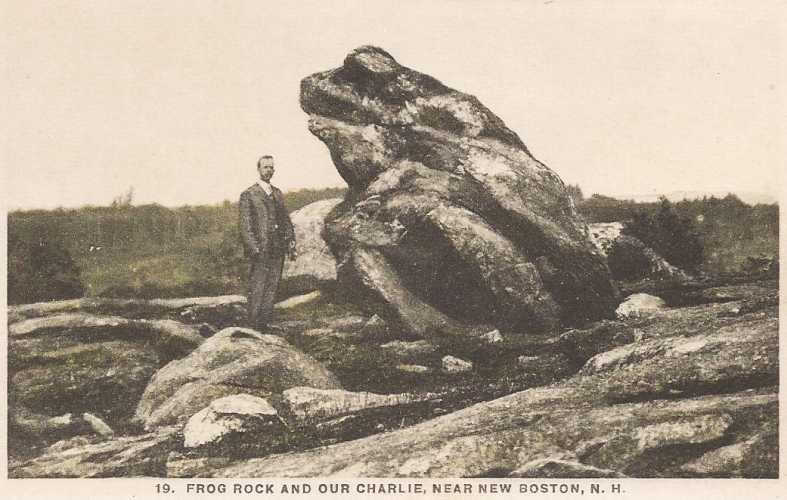
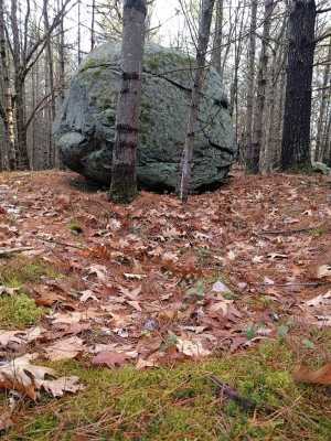
Frog Rock before it was reclaimed by the forest
Frog Rock
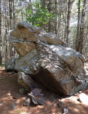 Frog Rock is a large granite boulder which may be found in the southwest corner of New Boston — if you know where to look.
It doesn't appear on most maps and there are no Frog Rock signs to guide you to its location, so we will provide some directions on this page.
We will also point out a number of interesting things you should look for when you visit Frog Rock,
because your amazement at seeing a large rock which looks like a frog will probably diminish after a minute's contemplation.
Frog Rock is a large granite boulder which may be found in the southwest corner of New Boston — if you know where to look.
It doesn't appear on most maps and there are no Frog Rock signs to guide you to its location, so we will provide some directions on this page.
We will also point out a number of interesting things you should look for when you visit Frog Rock,
because your amazement at seeing a large rock which looks like a frog will probably diminish after a minute's contemplation.
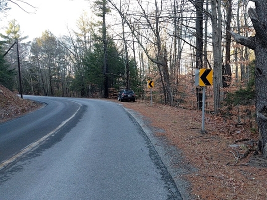
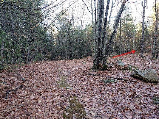
The easiest way to get to Frog Rock is by walking in from the Francestown Turnpike. (Why an ordinary two-lane road is called a "Turnpike" is one of the interesting things we'll get to in a moment.) The Turnpike end of Frog Rock Road does not have a street sign, so what you need to do is drive south from Lyndeborough Road on the Francestown Turnpike past Hopkins Road to the Mont Vernon town line, then turn around and drive north very slowly.
You'll see a brown apartment building on your left (the Hartwood Apartments at 290 2nd NH Turnpike - this used to be the Tollhouse Variety Store; we'll explain why later) and a house on your right. Where the road bends left a hundred yards past this house, there's an unmarked pull-off on the right by a pair of yellow & black arrows which warn of the turn.
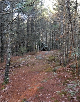
Near to Frog Rock is Tipping Rock, sometimes called Teetering Rock, which theoretically can be moved back and forth by hand. (We think we found the right rock but it didn't budge for us.) These two rocks were quite the tourist attraction around 1900, when summer visitors came from Boston to New Hampshire hotels to escape the heat of the big city. The Grand Hotel in Mont Vernon would send wagonloads of guests to Frog Rock for picnics. Note that Frog Rock appears in The Grand's promotional literature below. (New Boston had a not-very-grand hotel called "The Tavern" and several summer boarding houses whose guests also liked to picnic at Frog Rock.)
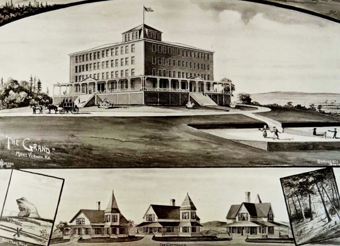
The Grand Hotel advertises "Bullfrog Rock"
Visitors to Frog Rock from Mont Vernon's five hotels came up the Turnpike, which was officially called the Second New Hampshire Turnpike. This road was built around 1800 to connect Amherst NH with Claremont NH. Its route was an almost-straight line between the two towns, without much regard for hills and valleys. Tolls were collected at toll-houses like the one on the Mont Vernon / New Boston town line. The word "turnpike" comes from the barrier which was lowered to make travelers stop to pay the toll. Tolls were 1 cent per mile for a horse and rider, 1 cent for every 10 sheep or hogs, 3 cents for a 4-wheel coach with 2 horses, and so forth. Once when a wagon driver failed to stop and pay his toll, the young toll-keeper leapt onto the wagon and took the man's hat, returning it only when the toll was paid.
The tolls paid the costs of road construction and maintenance and were supposed to reward investors with a profit, but the Second New Hampshire Turnpike went bankrupt in 1837 and no tolls were collected after that date.
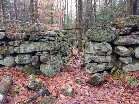
Tipping Rock and Read Brothers farmhouse
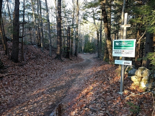
Once you've admired Frog Rock and tried to tip Tipping Rock you might want to continue north (downhill) on Frog Rock Road. The cellar holes of the Read Brothers Farm will be on your left, less than 100 yards north of Frog Rock. There's an old well, the stone foundation for a medium-sized farmhouse, and beyond that the stone walls which supported what must have been an enormous barn, 40 feet wide by 92 feet long! The Read Brothers owned this farm when the 1892 map of New Boston was printed; Benjamin Colby owned the farm in 1858. The pamphlet "Under the Firehouse Roof" tells us the Colby place burned in 1903. Charles Read once tried to sell Frog Rock to the Town of New Boston to serve as a War Memorial.
 Colby Pond
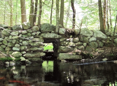
Go further north on Frog Rock Road to find Colby Pond, presumably named after the 1858 farmer. You won't see the pond from the road; it's uphill above the road on your left (to the west), unmarked like everything else on Frog Rock Road. Colby Pond is a glacial kettle hole which looks like a miniature Crater Lake, and it has no obvious inlets or outlets. If you're not interested in geology you might give Colby Pond a miss, but do admire the stone bridge on Frog Rock Road that's in the vicinity of the pond - you'll walk across its twin arches.
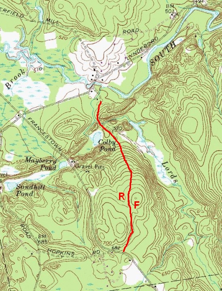
The topographic map (right) shows Colby Pond, Frog Rock Road in red, and red letters to indicate the approximate locations of Frog Rock and the Read Brothers farmhouse.
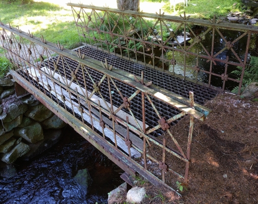
The footbridge over Lord's Brook has ornate railings which once decorated the New Boston Railroad Depot Bridge.
 The northern end of Frog Rock Road crosses a footbridge at Lord's Brook and goes through the property of a private home.
This home once included a restaurant owned by Levi Woodbury "Lucky" Lord in the 1940s-50s.
A 1948 advertisement for "Lord's Brookside Dining Room - Famous For Fine Food (formerly of Nashua)" promised "Complete Dinners from $2.00".
Ruth Grant remembers that when her mother was a waitress at Lord's restaurant, the Secretary of the Navy came to visit and left her a big tip.
The northern end of Frog Rock Road crosses a footbridge at Lord's Brook and goes through the property of a private home.
This home once included a restaurant owned by Levi Woodbury "Lucky" Lord in the 1940s-50s.
A 1948 advertisement for "Lord's Brookside Dining Room - Famous For Fine Food (formerly of Nashua)" promised "Complete Dinners from $2.00".
Ruth Grant remembers that when her mother was a waitress at Lord's restaurant, the Secretary of the Navy came to visit and left her a big tip.
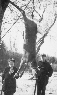
Lucky and Nellie Lord and their guests enjoyed hunting in the woods and fields around Frog Rock Road. (Photo of Nellie and Levi W. Lord (1876-1957) courtesy of the Harz family.)
 Again, the Lord's establishment is a private home now, so it would be polite to turn around at the footbridge
and retrace your steps.
As you go south towards where you left your car parked by the Turnpike about 2/3 of a mile away, look to your right after you've gone a hundred feet
past the stone bridge.
Again, the Lord's establishment is a private home now, so it would be polite to turn around at the footbridge
and retrace your steps.
As you go south towards where you left your car parked by the Turnpike about 2/3 of a mile away, look to your right after you've gone a hundred feet
past the stone bridge.
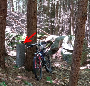
You'll see a granite post within a small lot bounded on three sides by a stone wall, which is the only reminder of the Papermill Village cemetery. Papermill Village, also called Gougeville, was once a busy neighborhood centered around Lyndeborough Road and Misty Meadow Lane, just north of Frog Rock Road. In addition to the King's paper mill there was a schoolhouse (now part of a private home), a church and a general store. The mill went out of business, the store and church disappeared, and the occupants of the cemetery were relocated to the graveyard on Cemetery Road above New Boston village.
Just beyond the south wall of the cemetery a well-worn path leads uphill to a view of Colby Pond, if you regret not visiting the pond earlier. The path does not go all the way around the pond; it ends on the Francestown Turnpike between Frog Rock Road and Lyndeborough Road. We recommend that you explore a little bit of the path around Colby Pond, take a selfie while standing on the ramparts of the kettle hole, and go back to Frog Rock Road by the old cemetery to return to your car.
Let us close our exploration of Frog Rock Road with an excerpt from the poem "Gougeville" from John Foster's 1908 Ballads of the Hills.
From "Colby Crest" Frog Rock looks down
Upon a saddened, ruined town.
Gone the village, gone the mill,
All gone but Frog Rock on the hill,
And if in stone, grief had a place,
Tears would course down its granite face.
October 2017 update: Frog Rock is the subject of a new 8-minute video posted on YouTube by outdoor adventurers Chuck and Cheryl. You may find their "Unique Hikes" channel at www.youtube.com/WeRmudfun.