New Boston Historical Society
New Boston, New Hampshire
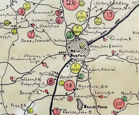
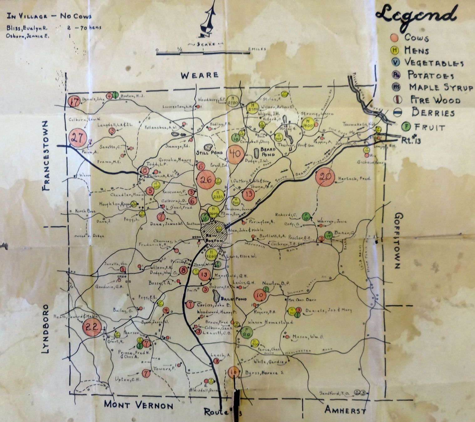
Detail of a 1938 map locating New Boston's cows and hens
Mapping the History of New Boston
This page contains scans of interesting maps from New Boston's 280-year history.
Where did people live? Where were roads, saw mills and schoolhouses?
Most maps are clickable, which will open in a new tab a larger, more detailed copy of the entire map.
1740 map
New Boston was first settled by Scots-Irish immigrants around 1736. There is a map of this First Settlement in a Dartmouth College library.
The library's
web page tells us that the map "appears to be on buckskin, suggesting the surveyor used the media that was closest at hand to plot out the township. It notes a stand of beech trees, a birch tree, and a 'heap of stones' as key markers...
This map, executed early in the town's history, shows numbered house lots, the mill, and lots dedicated to a school and a minister."
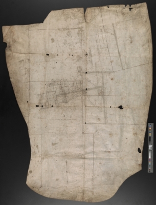
Buckskin map of New Boston's First Settlement, c.1740.
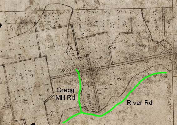
The map detail shows the Middle and South branches of the Piscataquog River and the village centered around a mill near today's Gregg Mill.
Modern roads are marked in green.
In December of 2013 the Rauner Special Collections Library scanned this remarkable map for us!
Click to see the
entire map or
a
detail of the 1740 town center.
These large images will open in a new tab or window - zoom in for stunning detail.
(Images courtesy of the Rauner Library)
1750s maps
In 1756, during the French & Indian War, a New Hampshire clergyman named Samuel Langdon drew
"An accurate map of His Majesty's Province of New-Hampshire in New England".
New Boston's first settlement had been abandoned by this time, mostly due to fear of the aforementioned French & Indians,
but some families from Londonderry NH decided to try again.
(See our
Early Years page for more information.)
A new grant for New Boston was issued in 1751 for a town
six miles square.
You will notice that New Boston isn't square-shaped in Langdon's map (below).
This is because in their 1751 charter the New Boston proprietors negotiated a little extra:
an additional grant of "fine lands and rich meadows" in what would later become Francestown.
When Francestown received its own charter in 1772, New Boston gave up the "Addition".
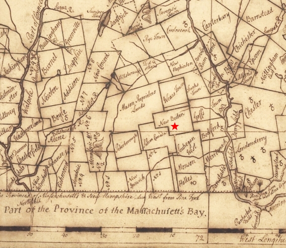 Detail from Langdon's 1756 map of New Hampshire. The Francestown Addition is the bump on the west side of New Boston.
The towns south of New Boston are "Salem Canada" (now Lyndeborough) and "Souhegan West" (Amherst).
Detail from Langdon's 1756 map of New Hampshire. The Francestown Addition is the bump on the west side of New Boston.
The towns south of New Boston are "Salem Canada" (now Lyndeborough) and "Souhegan West" (Amherst).
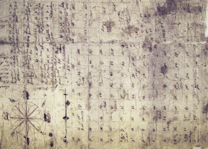 Detail from 1754 map of New Boston. Note that most lots are square and regular, drawn without regard to rivers or mountains or swamps.
This detail from a 1754 map also includes the Francestown Addition.
Like all maps on this page, it has been rotated so that the top of the map is North.
The worn, stained section of the map to the north-east corresponds to First Settlement in the 1740 map;
some lot numbers correspond to the 1740 plan and some don't!
Undoubtedly many fingers jabbed this map as people argued over property boundaries.
Lot numbers range from 1 to 40-something in the north-east quadrant (First Settlement area).
We believe a later surveyor laid out the lots in the other three quarters of New Boston and numbered the new lots from 1 (again!) to 120-something, so there are many duplicates.
1816 map
What was left of New Boston after 1772 was square-shaped.
This excerpt from a map of New Hampshire by Philip Carrigain is interesting because it shows the main roads in town as of 1816; some of these roads are not driveable today.
The Second N.H. Turnpike in the southwest corner of New Boston was built around 1800.
The hill labeled "Ingalls Hill" is Joe English Hill. The steepled church/meetinghouse was in the cemetery.
The center of town commerce shifted in the 1800s from the Upper Village (Cemetery Road/Meetinghouse Hill/Bedford Road)
to the Lower Village, the intersection of roads and river you see just north of the church.
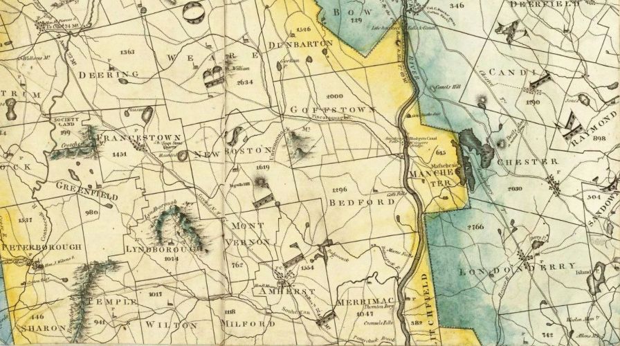 Excerpt from Carrigain's 1816 map of New Hampshire — click to make it bigger
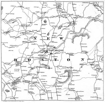
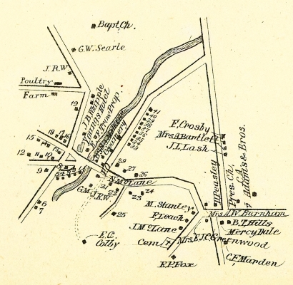
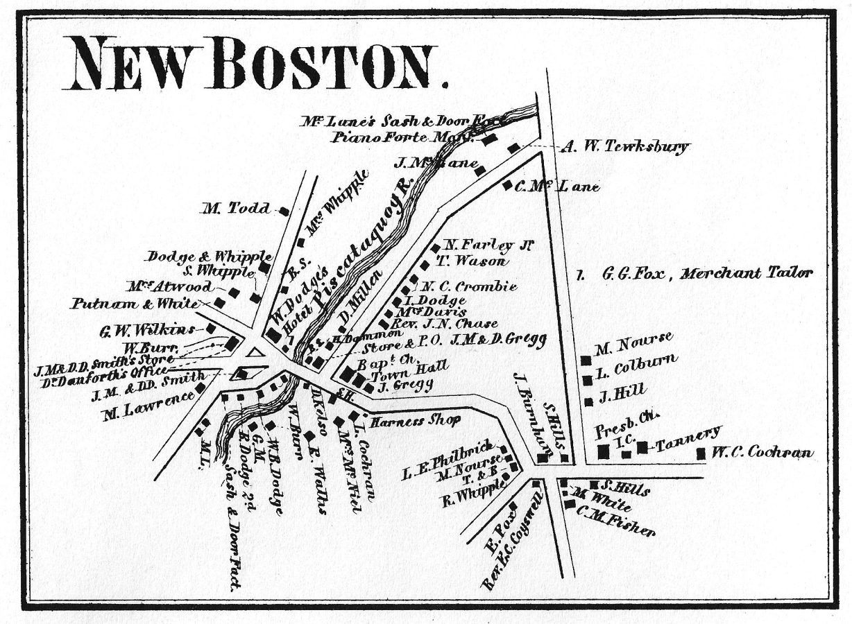
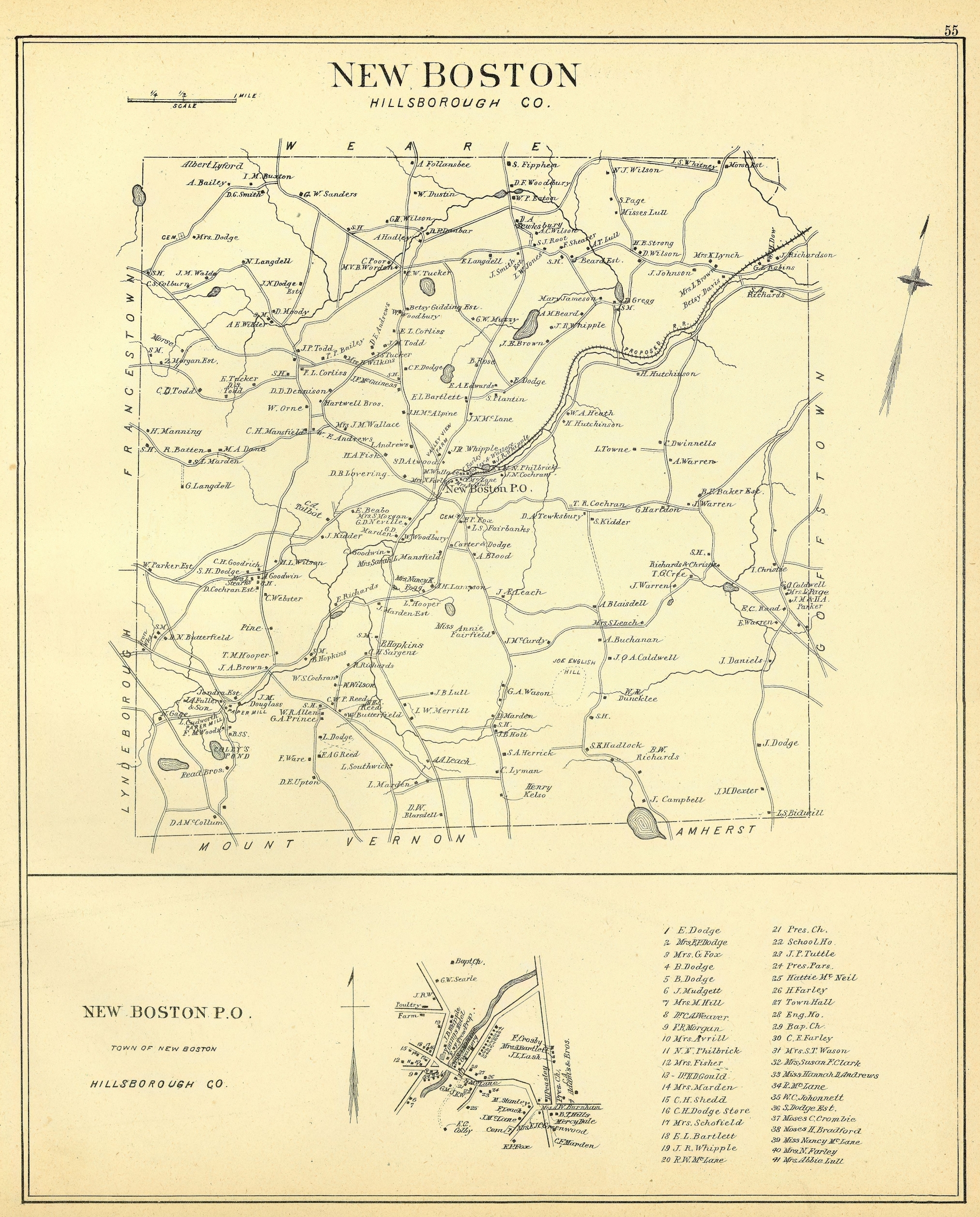
1858 map
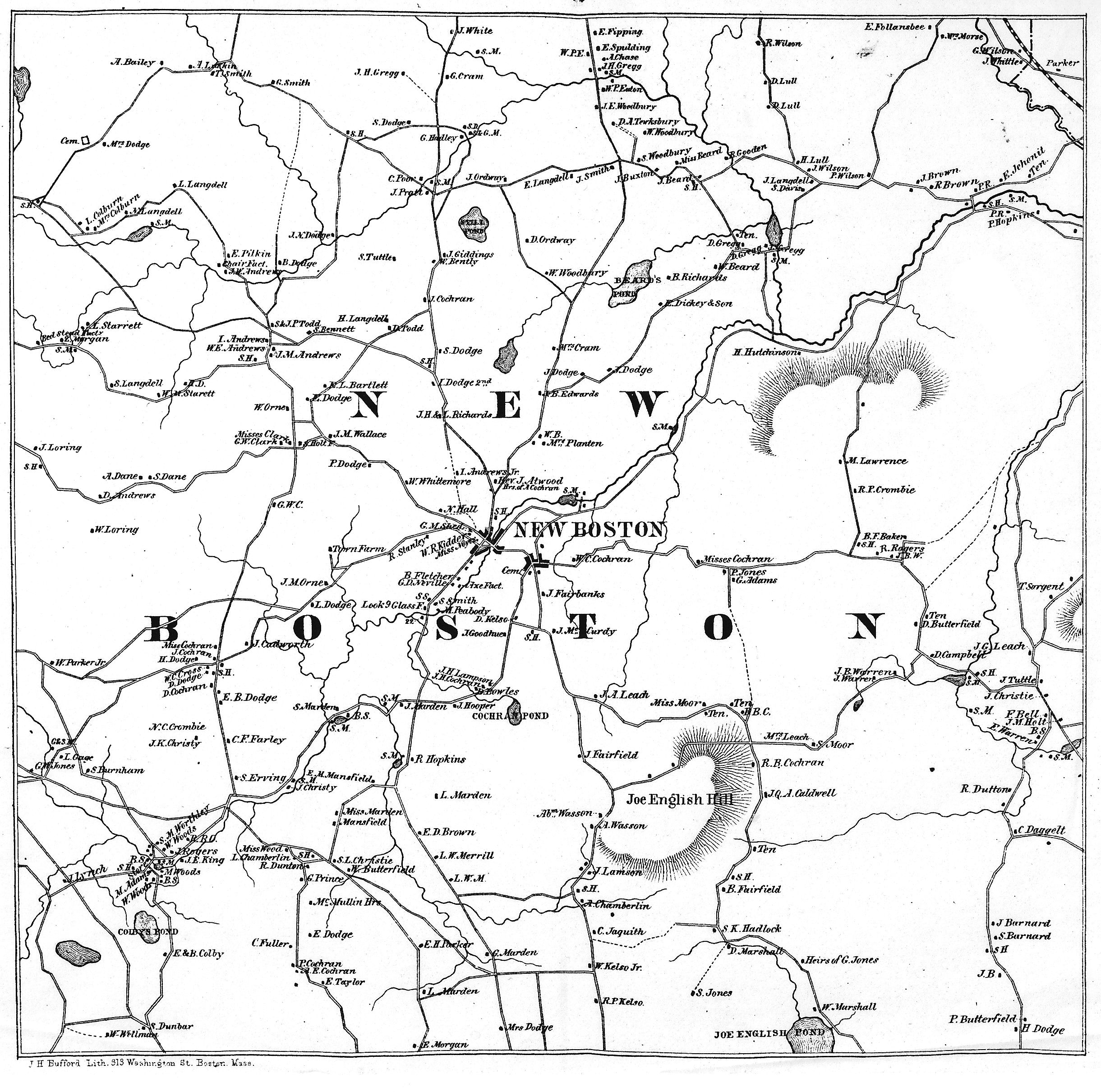
Jumping ahead 42 years, we have an interesting map drawn in 1858 and included in Cogswell's "History of New Boston".
This map and our 1892 map are extremely useful to the Historical Society as these maps identify
who lived
where.
Can you imagine making a map like this today, when many families move every few years?
The population of New Boston was about 1,400 when this 1858 map was drawn, and the map indicates about 200 households.
If you look at U.S. Census records for New Boston in the 1800s, you will notice that a farming household often had multiple generations:
an elderly grandparent or two, a husband and wife, their multiple children, plus a handyman or woman.
The maps also show the locations of one-room schoolhouses ("S.H.") and sawmills ("S.M."). Click the maps to make them bigger!
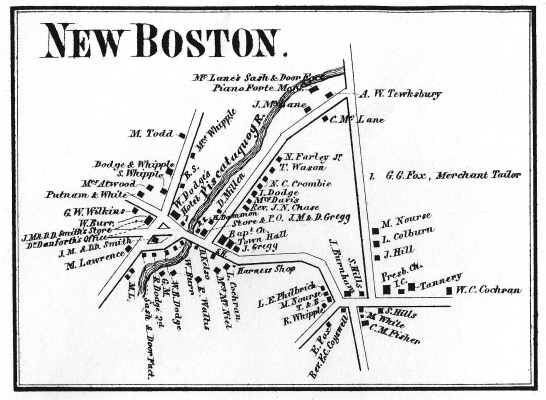
The roads in the 1858 town-wide map are drawn more accurately than the roads in the 1858 detail map of
the Upper and Lower Villages. Perhaps the mapmaker needed to squeeze in the business and family names.
In 2014, Robert Todd prepared a
Composite Plan showing lot numbers and structure locations, based on the 1858 map.
Lot lines are approximations; we believe that Bob intended these to match the 1754 settlement plan.
1892 map
In 1892, D.H. Hurd & Co. published "The Town and City Atlas of the State of New Hampshire" with a single sheet map for each town in the state.
The page for New Boston shows a "Proposed R.R." - the New Boston Railroad was completed the next year, in 1893.
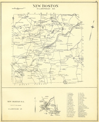
The 1892 map detail shows the village center, which still looks much the same today.
1938 map
A 1938 map of New Boston's "Commercial Agricultural Production" was drawn by someone named "D.W.H." at the Department of Agricultural Economics in Durham, NH.
Perhaps he or she was a student or employed by the Depression-era Works Progress Administration.
The map shows the relative sizes of herds of cows (orange circles) and flocks of chickens (yellow circles).
Donated by R. Todd.

(Click on the map to see a larger image.)
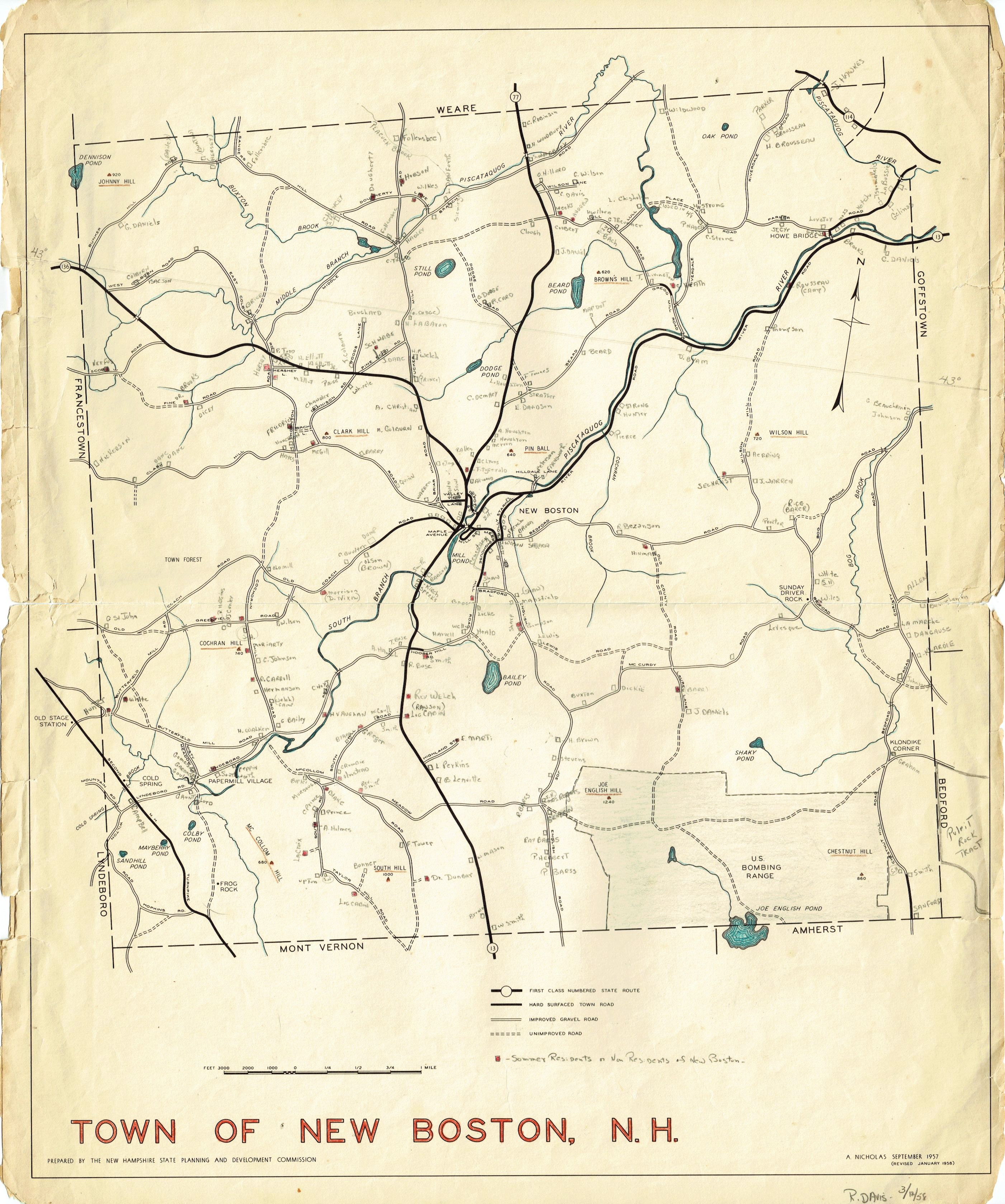
1958 map
In 1958 Rena Davis, the Historical Society's most accomplished and prolific researcher, marked the location of almost every house in New Boston and who lived there.
(Red squares indicate "summer residents.")
Donated by the Davis family.
(Click on the map to see a larger image.)
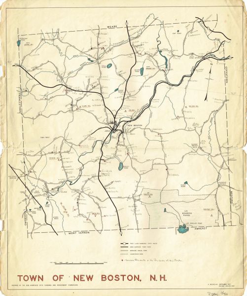
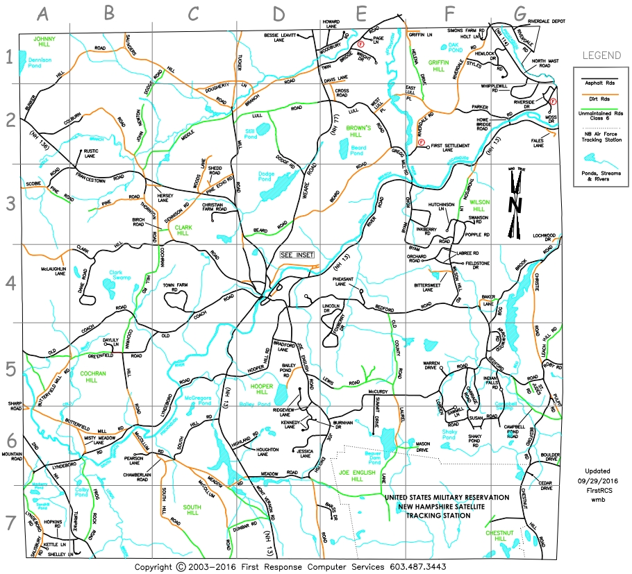
Today's maps
Up-to-date maps of New Boston may be found on-line using
Google or
Microsoft Bing
which offer you options for Satellite view, Bird's-eye view, Street view, etc.
The Town of New Boston Assessing Office has a
web page
with a link to Tax Maps; the "Index" map shows the entire town.
Note to researchers:
Volunteers at the New Boston Historical Society are often asked: "Do you know where my great-great-grandmother lived?"
We regret that we do not have a reference book which includes this information.
If we can't answer your question, we'll tell you "Many records were lost in the Fire of 1887" which is a valid excuse, sometimes.
Then we may refer you to the
Hillsborough County Registry of Deeds in Nashua, NH.
Or we may suggest you look in the Town report:
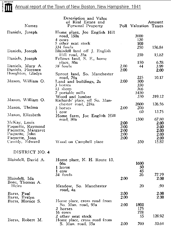
1941 New Boston Town Report
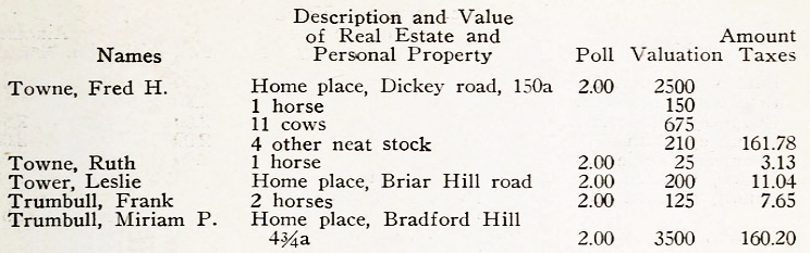
If you cannot find your ancestor's name on our 1858, 1892, 1938, or 1958 maps, another helpful resource is the annual Town Report,
which for many years listed a "Description and Value of Real Estate and Personal Property" for all taxpayers in New Boston, including how many horses, cows and sheep a person owned.
(Click
here for a sample.)
Some Town Reports include street addresses, while in other years you'll find only which school district someone lived in.
A map showing approximate locations of School Districts may be found on our
School page, or you may click here
here for the copy of the 1858 map with the schoolhouse numbers marked in red.
The University of New Hampshire has a
digital collection of New Boston Town Reports including most but not all years from 1918 to 2012.
Printed copies of New Boston Town Reports are available at the Historical Society and the Whipple Free Library.
 (Click on the map to see a larger image including the road index and town center inset.)
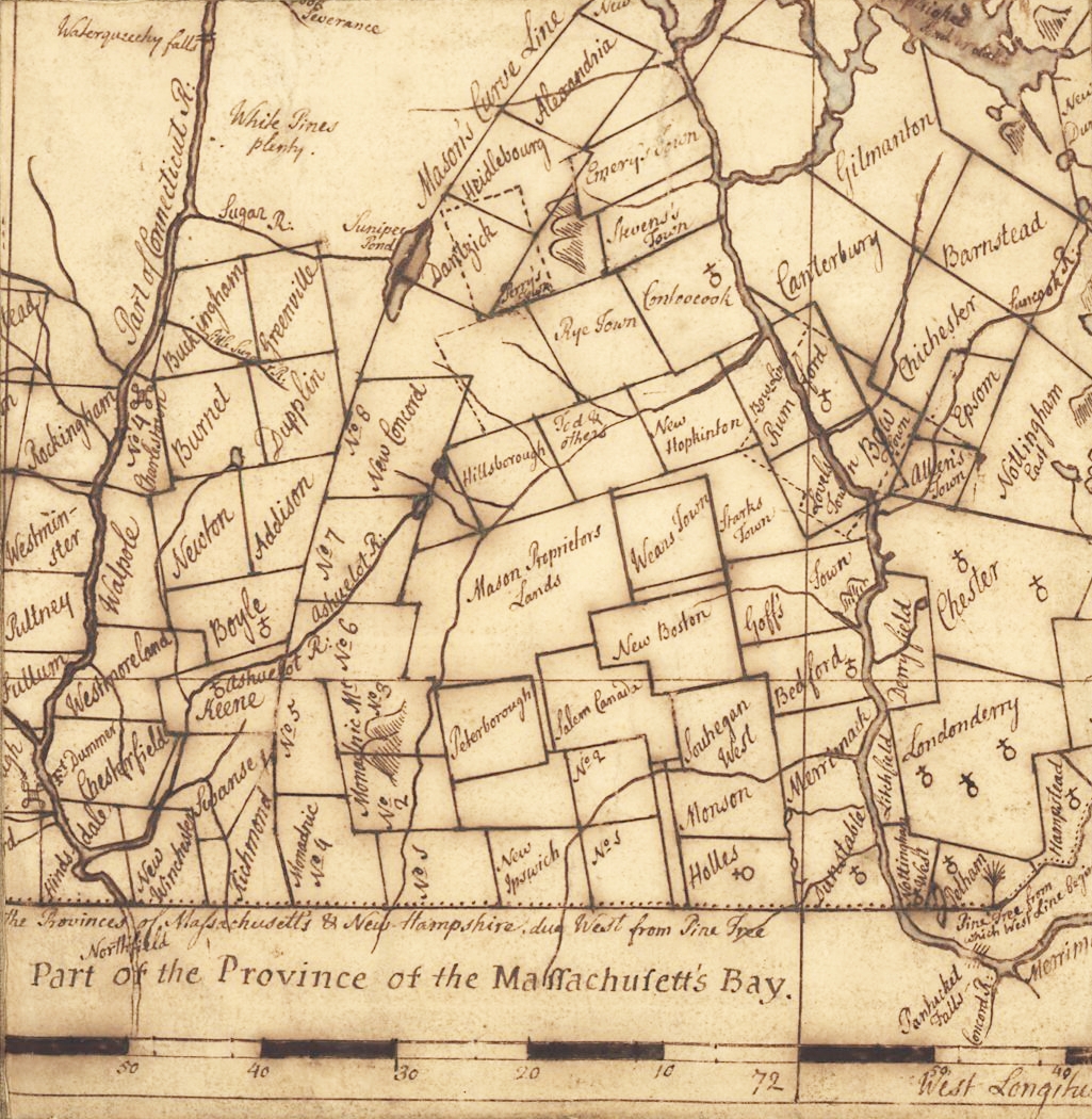 Detail from Langdon's 1756 map of New Hampshire. The Francestown Addition is the bump on the west side of New Boston.
The towns south of New Boston are "Salem Canada" (now Lyndeborough) and "Souhegan West" (Amherst).
Detail from Langdon's 1756 map of New Hampshire. The Francestown Addition is the bump on the west side of New Boston.
The towns south of New Boston are "Salem Canada" (now Lyndeborough) and "Souhegan West" (Amherst).
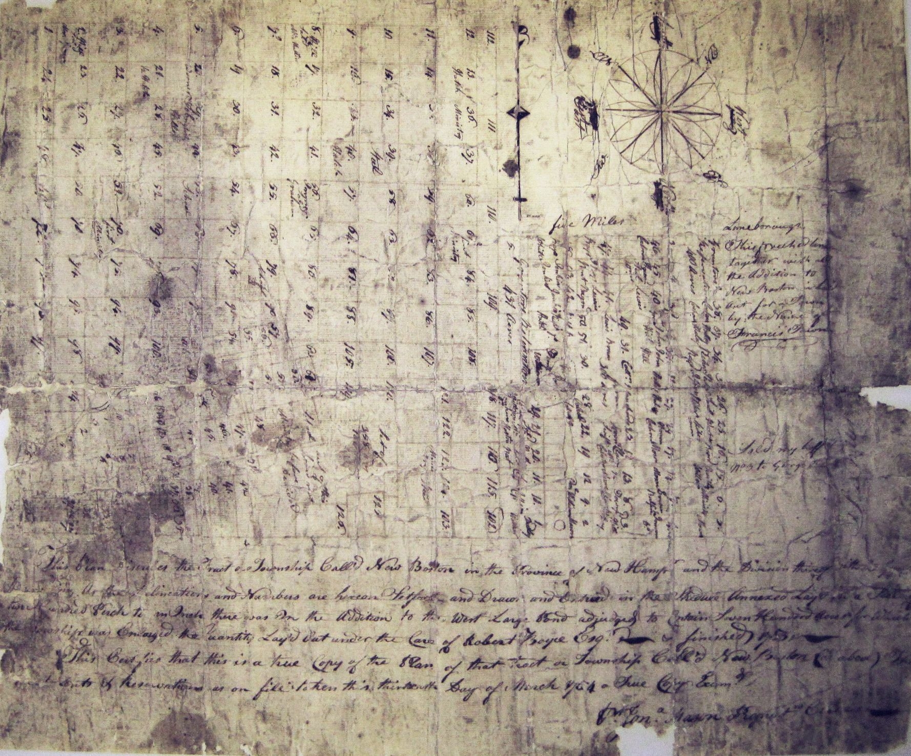 Detail from 1754 map of New Boston. Note that most lots are square and regular, drawn without regard to rivers or mountains or swamps.
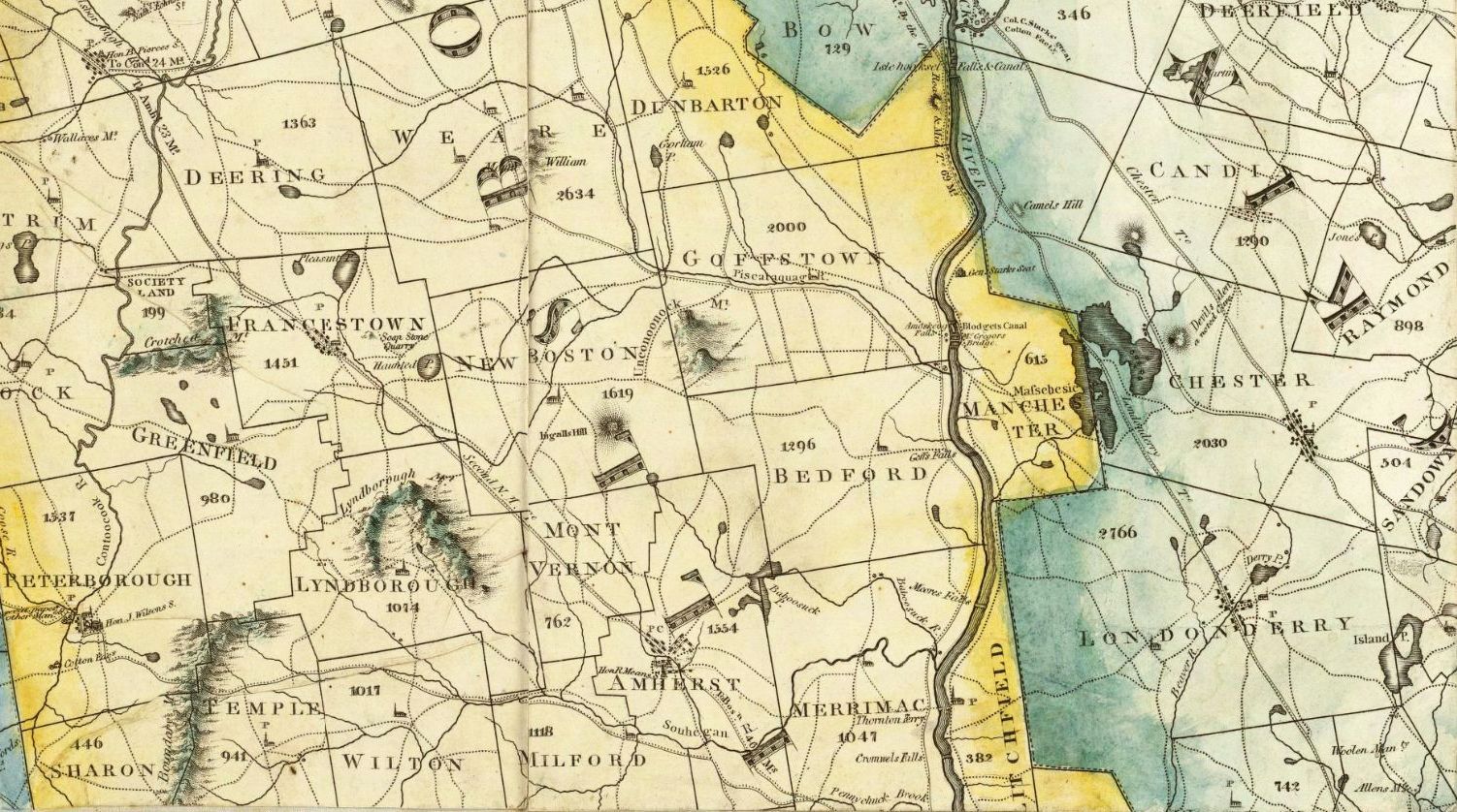 Excerpt from Carrigain's 1816 map of New Hampshire — click to make it bigger
 (Click on the map to see a larger image including the road index and town center inset.)